Project Funded
|
 |
 |
ELEvATE: Elevated Low Relief LandscapEs in Mountain Belts: Active
Tectonics
or Glacial REshaping? The Eastern Alps as
Natural Laboratory.
The project ELEvATE
will focus on the evolution of elevated low relief
landscapes (plateaus) in active mountain ranges. The
project is funded by the Austrian Science Fund
(FWF) and the government of Salzburg
for a period of three years and will commence
in March 2019.
Abstract of the proposal
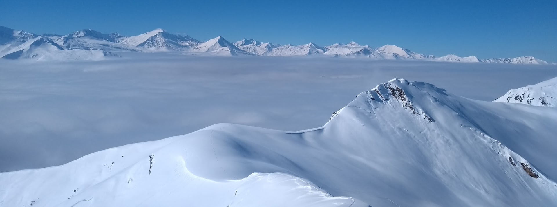
Elevated low relief landscapes are an abundant
feature in mountain ranges worldwide. This peculiar
topographic pattern, which is indicated by a
transition from increasing to decreasing slopes with
elevation, has been explained by temporal changes in
climate or tectonics. This ultimately culminates in
two opposing hypotheses:
The hypothesis of glacial reshaping explains
the large scale topographic pattern by a buzz-saw
style erosion of glaciers above and localized
excavation of valleys below the snowline of ice
covered regions, respectively. Elevated low relief
landscapes must then occur within a formerly glaciated
part of the mountain range, at or above the
equilibrium line altitude. In the Alps, they must have
formed after the mid-Pleistocene climate transition.
Elevated low relief and incised landscapes form
simultaneously, whereas the degree of glacial
reshaping and the size of low relief surfaces increase
with the duration of glacial occupation.
The hypothesis of fluvial prematurity
explains the topographic pattern of low relief
landscapes at high elevations and incised landscapes
at low elevations by a recent uplift event, where the
two contrasting landscape types represent the ancient
and recent tectonic regime, respectively. In this
scenario low relief landscapes are uplifted first and
dissected subsequently, with the result that their
size decreases with time. Within this interpretation,
elevated low relief surfaces are not correlated to the
glacial extent and may have formed before the
mid-Pleistocene transition.

In order to proof or refute these two opposing
hypotheses we propose to perform a study in the
Eastern Alps where both glaciated and never-glaciated
regions exist in direct spatial proximity. We pose
three specific questions that will be answered by this
project. (1) Where do we observe elevated low-relief
landscapes and incised landscapes within the Eastern
Alps? (2) When did low relief- and incised landscapes
form and at which rates? (3) How did the observed
topographic pattern evolve over time?
To reach these goals we will perform a
series of analyses in two adjacent areas that were and
were not covered by ice during the Pleistocene
glaciations. The two key areas are perfectly
complementary as they feature a similar lithological
and structural inventory but differ with respect to
their glacial history. We plan three major work
packages: (1) We will map the regional pattern of
elevated low relief and incised landscapes by
compiling existing maps and analyzing digital
elevation models. (2) We will apply cosmogenic nuclide
dating to determine the absolute age of landforms (via
cave proxies) and compute incision rates. (3) We will
model multiple scenarios to constrain the
time-dependent evolution of elevated low relief and
incised landscapes during cold and warm climate
conditions.
By integratin the results of these three
methodically independent work packages, we are
well-positioned to proof or refute the two opposing
hypotheses in order to infer drivers of landscape
evolution in the Eastern Alps. Beyond the Eastern
Alps, findings from this project will have far
reaching implications on the understanding of relief
formation and destruction in mid-latitude mountain
ranges.
Key findings
The project involved two parts conducted in tight
cooperation between the universities of Salzburg (PI
Robl) and Graz (Co-PI Stüwe), respectively. The two
parts involved (a) field and laboratory work to
determine the latest uplift history of the Eastern
Alps and (b) the numerical description of topographic
changes in mountain ranges during strong climate
fluctuations as characteristic for the late Cenozoic.
The two parts will be described separately below:
The
field and laboratory work involved mapping of elevated
low-relief surfaces and geochronological dating of
cave sediments as proxies for the uplift history. Both
aspects revealed extremely relevant findings for the
field of tectonic geomorphology as they substantially
consolidated ideas that have been around the community
for the last 10 years. It could be shown that the
surface uplift of the Alps did indeed occur about 5
times as fast as previously thought. This idea had
been around since about 15 years, but has always been
based on sketchy and few data. Here we dated some 45
caves at different elevations above base level and
could show that the mean surface uplift rate was of
the order of 0.2 mm/year for the last 5 Ma and that
this surface uplift appears to have been more or less
homogeneous across the eastern Alps.

Mapping
of elevated low-relief surfaces was performed across
much of the Eastern Alps and it was shown that there
is no recognizable difference between these surfaces
in regions that were glaciated in the Pleistocene and
regions that were not. As such, we were able to
contribute to a long-standing debate that discussed if
these surfaces were glacially formed or if they are
remnants of old valley floors (Piedmont Treppe). We
can now confirm that they are indeed relics of a
“Piedmont Treppe”. A detailed map of the elevated low
relief surfaces combined with cave levels across the
Eastern Alps is in the process of being submitted to
the journal Geomorphology (Gradwohl et al., in prep).
The results of the cosmogenic burial age dating of
cave sediments are presented in a manuscript, which
will be soon submitted to the journal Earth and
Planetary Science Letters (Stüwe et al., in prep). The
methods used for both manuscripts have been used in
the past (geomorphological mapping in the field and
cosmogenic burial age dating of caves) and are well
established methods in this field. However, we used
them to derive completely new data, in particular with
cosmogenic 21Ne.

The numerical work involved the morphological
analysis of a large portion of the formerly glaciated
and never glaciated parts of the Eastern Alps to
quantify elevation-dependent topographic metrics
(e.g., slope vs. elevation distribution) and to
describe the evolution of characteristic patterns in
topography during the transition from fluvial to
glacial conditions by employing landscape evolution
models (iSOSIA and OpenLEM). In the last two decades,
the “glacial buzz saw” hypothesis became popular in
explaining hypsometric maxima (expressed by low relief
surfaces) close to the ELA by a somewhat vague
mechanism of cirque formation and summit decay above
the equilibrium line altitude (ELA).

Thus, we tested whether glacial erosion led to, or at
least significantly contributed to, the formation of
the low relief surfaces observed in many places in the
Eastern Alps. In all our numerical experiments, flat
valley floors and steep valley flanks evolved during
the fluvial to glacial landscape transformation, but
we did not observe the formation of extended low
relief surfaces at or above the ELA as proposed by the
glacial buzz-saw hypothesis. Our results show that the
observed extended low relief surfaces in the Alps
cannot be explained by impact of the Pleistocene
glaciation of originally fluvial steady state
topography.  However, we found that enhanced glacial
erosion in the main valleys results in an average
increase in slope below the ELA. The striking turning
point in the slope elevation distribution close to the
ELA can thus be explained by steepening of the terrain
below the ELA, instead of the destruction of peak
topography. The model results are consistent with
topographic metrics of catchments in the Eastern Alps
that were affected by a different degree of glacial
erosion (Liebl et al., 2021). However, we found that enhanced glacial
erosion in the main valleys results in an average
increase in slope below the ELA. The striking turning
point in the slope elevation distribution close to the
ELA can thus be explained by steepening of the terrain
below the ELA, instead of the destruction of peak
topography. The model results are consistent with
topographic metrics of catchments in the Eastern Alps
that were affected by a different degree of glacial
erosion (Liebl et al., 2021).
Experiments on orogen-scale over multiple
glacial-interglacial cycles pushed the model iSOSIA to
its performance limit. A novel approach to describing
glacial erosion based on the so-called glacial stream
power law in analogy to the classical stream power law
for rivers offered a solution. Since this approach
(recently implemented in the model OpenLEM) has
several limitations, its application has been
controversial in the scientific community. To avoid
acceptance problems in upcoming studies, we conducted
a comprehensive benchmark study, in which we extended
OpenLEM, calibrated the parameters, and compared the
results with iSOSIA in detail. Results show that
large-scale topographic patterns as well as their
temporal evolution are well in line between the two
models with differences being most pronounced at the
first glacial advance and locally at the scale of
individual landforms. Code enhancements and the
calibration of the parameters in connection with the
superior computational performance enable completely
new experiments in the field of landscape evolution in
active mountain ranges and holds the potential to
change the way we understand mountain landscapes
(Liebl et al., 2023).
Coupled
models for the Eastern Alps accounting for fluvial and
glacial erosion, sediment transport and deposition,
orographic precipitation and flexural isostasy show a
number of intriguing relationships between intensity
and time of glacial occupation, isostatically driven
uplift, and catchment-wide topographic metrics. This
study is currently under preparation and will be
submitted to Earth Surface Processes and Landforms
(Robl et al., in prep.).
|